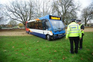
Victoria Road in Cambridge, 20mph, and Stagecoach — the data

Cambridge has begun implementing 20mph speed limits in residential areas, and some major roads or areas are coming up for approval soon, particularly Victoria Road (for those who don’t know Cambridge, a rather narrow, relatively busy road, currently at 30mph).
Following what seems to be a national strategy, the local bits of the national bus company Stagecoach, being the type of company they are, use this as an excuse to cut services or raise fares where it’s implemented, and raise the threat of cuts where it is considered. That’s fine for their commercial arguments, but what about the public’s interests?
Stagecoach refuse to release any data on which they base those statements, despite collecting it routinely. Assertions that support Stagecoach’s position are made, and Stagecoach require the public to accept Brian Souter’s pronouncements as true.
So here’s some data: tab (you probably want this one) or sql. For the month of June 2014, once a minute, I saved a copy of all the live bus displays for various bus stops in Cambridge. Journeys between them can then be tracked and likely speed windows calculated. Sporadic checks shows the data was accurate against busses at stops at the times the display said they were.
Given the range and nature of complaints about Stagecoach in Cambridge, I suspect a variety of anecdote can be substantiated from this or similar data. Where bus routes aren’t being honoured in the evening, does this data show what happened to the bus later in the problematic journey?
I’ll draft a note of my analysis (help would be appreciated), but the raw data is open for others to do use as well (a credit would be nice, and I’d be interested in seeing what you do with it).
A data based discussion on an aspect of policy? I’m sure Stagecoach wont be entirely happy with that, but they could always release a complete copy of 2 weeks of bus GPS traces.
(image source: cambridge news)
Update: distance for Victoria Road bus stops; from the top end of Histon Road, before the turn onto Histon Road, to the bus stop at the bottom of Histon Road, is 1.4 miles. From the last bus stop on Histon Road (just before the traffic lights), to the last bus stop on Victoria Road is 0.7 miles.
Stop IDs:
'0500CCITY073',# 8 Top of Victoria Rd --in
'0500CCITY075',# 8 Top of Victoria Rd --out
'0500CCITY095',# 8 Bottom of Victoria Rd --in
'0500SGIRT006', # Girton, --out
'0500SGIRT009', # Girton, --in
'0500CCITY496',# (B) 5/6/B Shire Hall -- in
'0500CCITY394',# (others) 5/6/B Shire Hall -- in
'0500CCITY401',# (others) 5/6/B Shire Hall -- out
'0500CCITY497',# (others) 5/6/B Shire Hall -- out
'0500SORCH012',# 8/B top of Histon Rd --in
'0500SIMPI022',# 8/B top of Histon Rd --in
'0500SORCH013', # B at top of Histon Rd -- out
'0500SIMPI006', # 8 at top of Histon Rd -- out
'0500CCITY321',# 1/etc Regent St --in
'0500CCITY063' # 1/etc Hills Rd --in
 Disruptive Proactivity